May 31, 2013, started like any other "high risk" day in central Oklahoma. Chasers were everywhere. You've probably seen the footage—grainy, shaky, and loud with the sound of wind ripping through microphones. But the el reno tornado video isn't just one clip. It’s a massive archive of data that literally changed how we understand atmospheric physics and chaser safety. Honestly, before this day, the idea of a seasoned, professional chaser dying in a storm was almost unthinkable.
Then came El Reno.
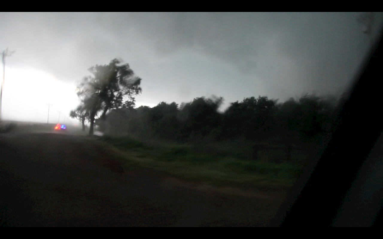
The storm was a monster. It wasn't just big; it was 2.6 miles wide. That’s a record, by the way. Most people don't realize that a tornado that wide doesn't look like a "tornado" when you're close to it. It looks like the entire horizon is just... gone. It’s a wall of grey and black.
The Video That Changed Everything
When you search for an el reno tornado video, you’re usually looking for one of three things: the TWISTEX escape, Dan Robinson’s harrowing dash, or the Weather Channel’s "Tornado Hunt" vehicle getting tossed like a toy.
Dan Robinson’s footage is perhaps the most bone-chilling. He was driving a Toyota Yaris. Yeah, a Yaris. In his rear-view camera, you can see a white Chevrolet Cobalt. That was the TWISTEX team: Tim Samaras, his son Paul, and Carl Young. Dan escaped because his car had just enough lead. The Cobalt didn't.
The video shows the moment the tornado does something it wasn't "supposed" to do. It took a sharp, 30-degree turn to the north and accelerated from 20 mph to nearly 60 mph in seconds. Basically, the storm sprinted.
Why This Particular Storm Was a Deathtrap
- The Size: At 2.6 miles wide, if you're within two miles of the center, you're already inside it.
- The Sub-Vortices: These are smaller, faster "mini-tornadoes" spinning inside the main one. Radar measured these at 313 mph.
- The Rain: It was rain-wrapped. You couldn't see the edges. You just saw a "bear's cage" of water and debris.
- The Roads: Oklahoma red dirt turns into "grease" when it gets wet. Dan Robinson’s traction control kept kicking in, slowing him down while he was trying to floor it to stay alive.
What the Radar Saw
While the el reno tornado video captures the terror, the RaXPol mobile radar from the University of Oklahoma captured the science. This thing was an EF3 on the ground because it mostly hit wheat fields, but the radar showed EF5-strength winds just above the surface.
It’s a weird nuance of the EF scale. If a 300 mph wind hits a cow pasture, it's an EF0 or EF1. If it hits a skyscraper, it's an EF5. That’s why the National Weather Service eventually settled on an EF3 rating, despite the radar data being terrifying.
Scientists like Howard Bluestein and Jana Houser have spent years syncing up the el reno tornado video clips from hundreds of chasers to create a "3D map" of the storm. By using the lightning flashes in different videos, they can sync the time down to the millisecond. It's basically the most documented weather event in human history.
The Legacy of the TWISTEX Team
Tim Samaras wasn't a "cowboy" chaser. He was an engineer. He built probes to measure pressure drops. He was the guy you'd trust with your life in a storm. His death sent shockwaves through the community.
His last video shows him calmly assessing the storm. He says, "Actually, I think we're in a bad spot." That’s it. No screaming, just a professional realization that the atmosphere had changed the rules.
Lessons for the Next Big One
If you’re watching an el reno tornado video today, don't just watch it for the "wow" factor. There are real, actionable takeaways here.
- Don't trust the path: Tornadoes aren't trains. They don't stay on tracks. They can "loop" or "jog" instantly.
- Wider is weirder: If a tornado looks like it isn't moving, it’s likely coming right at you or it's so wide you're already in the danger zone.
- Infrastructure matters: On May 31, the highways were clogged with people trying to flee. Had the tornado stayed on its path toward Oklahoma City, the death toll would have been in the hundreds because of the gridlock.
To really wrap your head around the scale of this, you should look up the "El Reno Survey" by the University of Oklahoma. It’s a project that geolocates every single chaser video from that day onto a single map. You can see exactly where Tim Samaras was compared to the edge of the condensation funnel. It’s a sobering look at how even the best in the world can be caught by a "black swan" event.
Check out the NWS Norman archives for the full meteorological breakdown of the dryline and the "outflow boundary" that caused the storm to behave so erratically. Understanding the "why" behind the wind is the only way to stay safe when the sirens actually go off.